
Aurora Neighbor Lookup Sources
Public sources describe a block in layers. A parcel viewer draws lot lines and may show a recorded owner. The assessor adds tax and mailing fields. MyPlace supplies Aurora ward, county, ZIP, and service context. Neighborhood-group pages identify civic geography, but they publish no membership roster.
| Source | What It Shows About a Block | Access |
|---|---|---|
| County GIS | Parcel lines, PINs, recorded owner or mailing output | Free online viewers |
| County assessor | Owner, situs, tax mailing, sale and parcel facts | Free county portals |
| Aurora MyPlace | County, ward, ZIP, districts and nearby services | Free city map |
| Neighborhood Groups | Group name, ward, meeting and contact context | City list and map |
| Voter tools | Personal registration or limited address confirmation | Restricted by Illinois law |
A tax-mailing address can differ from the parcel’s situs address. A named owner may be a trust, estate, or person living elsewhere. State findings as parcel facts, not claims that a person currently occupies the home.
Map an Aurora Block
Start with the target parcel, then move only to lots that touch it or face it across the road. Save the map date, PIN, county, subdivision, and block. Aurora’s county lines mean adjoining addresses can require different assessor and recorder systems.
- Find the address in Aurora MyPlace and save its county and PIN.
- Open that county’s GIS and select the parcels beside, behind, and across from it.
- Confirm each PIN in the assessor roll and compare situs with tax-mailing address.
- Record only what the official field proves, then date the result.
A full named-road chain belongs in the Aurora street directory. The neighbor method stays focused on the immediate block.
Kane Buffer Finds Nearby Parcels
The Kane neighboring-parcel Buffer starts with a PIN or address and a chosen distance. It returns mailing-address information for parcels in that range. Convert each result back to its PIN before drawing conclusions, since mailing output is not an occupant list.
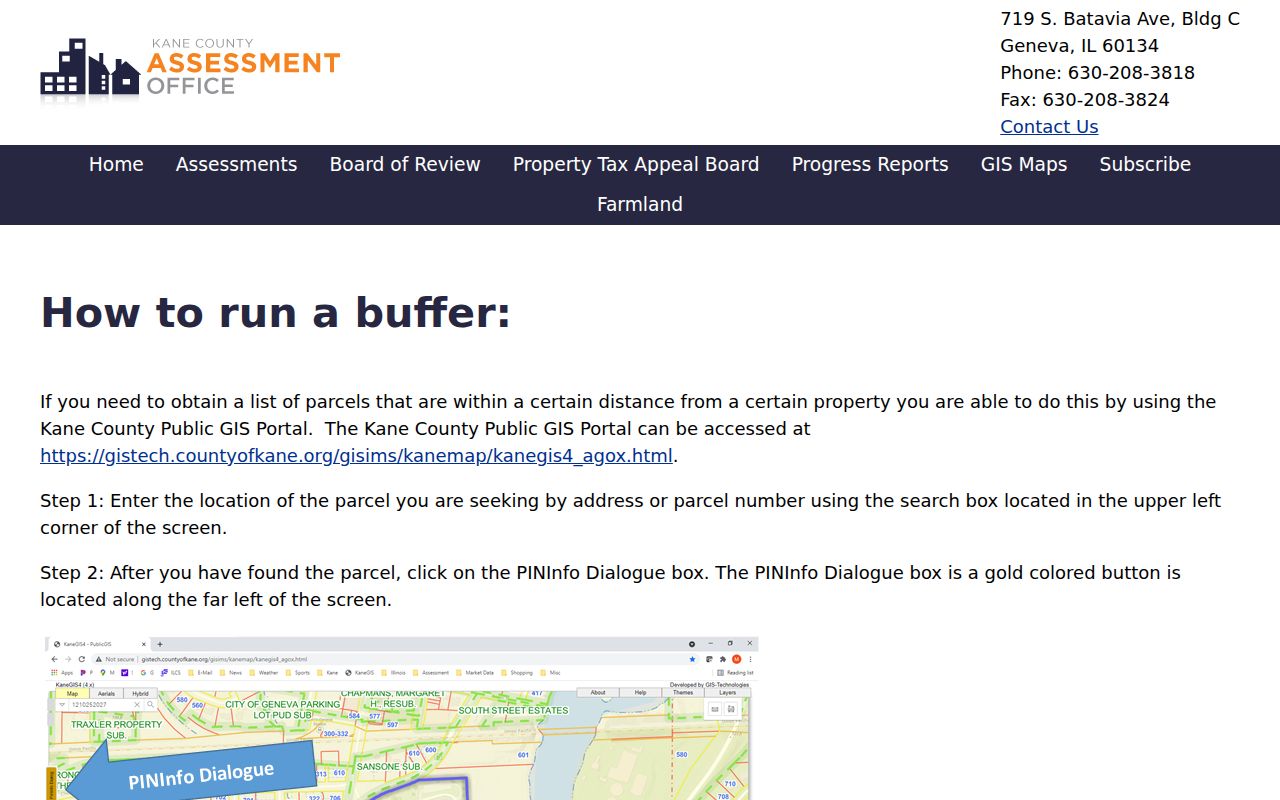
The distance control builds a repeatable research radius instead of relying on a visual guess.
KaneGIS Checks Aurora Parcels
The KaneGIS parcel map supplies geometry and county context for Kane-side Aurora neighbors. Compare its selected parcel with the assessor result, because a map label and a tax record may refresh on different dates.
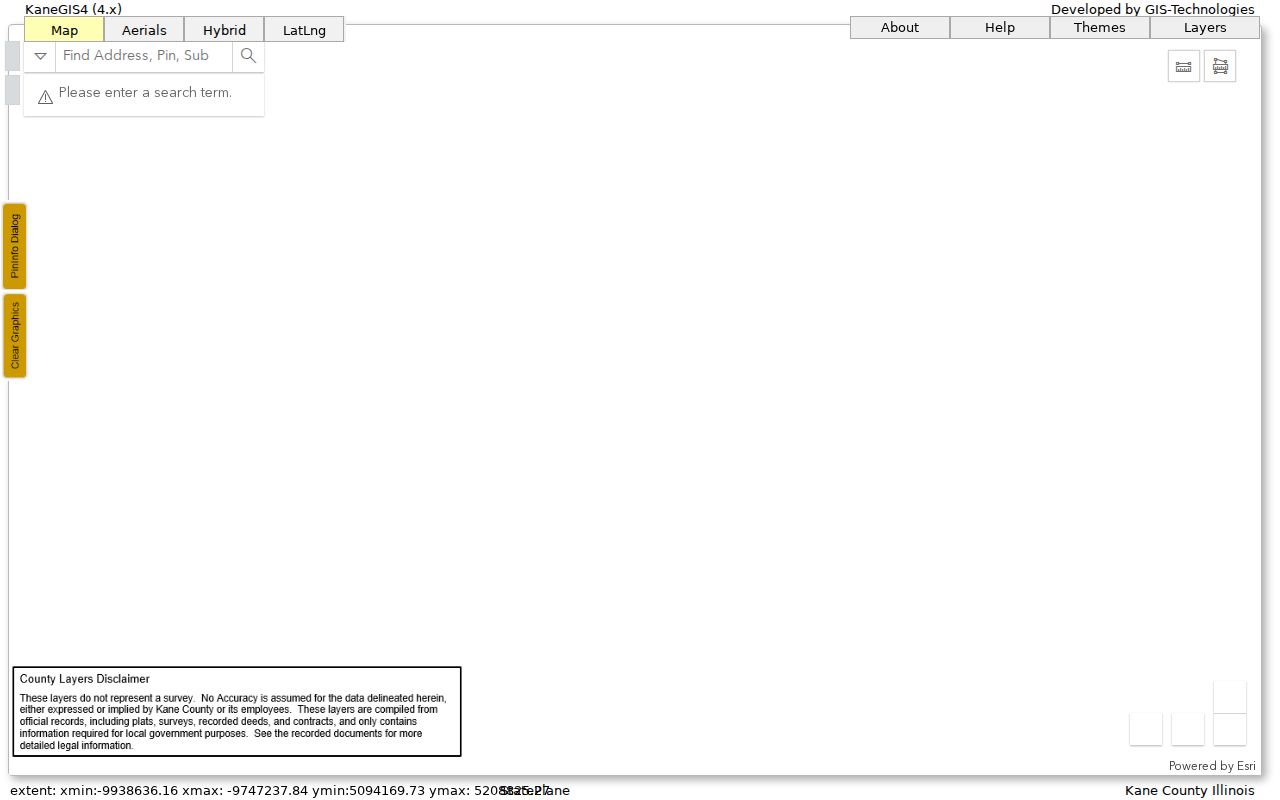
The mapped lot line helps distinguish a true adjacent parcel from a nearby mailing point.
Kendall and DuPage Block Tools
Kendall County’s official property-information guide documents its quick lookup and map route. The inspected Kendall DevNet snapshot also carried a dated data update, which should be saved with any result.
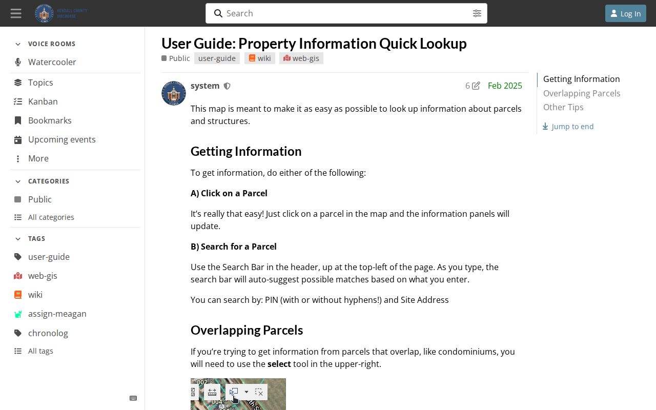
The guide provides a county-specific route when an Aurora address falls beyond Kane.
DuPage Parcel Viewer offers a “Search surrounding area” control plus TXT, Download, and ReportToPDF outputs. Those exports make a block search reproducible. Will County GIS supplies parcel and district layers, but the captured page failed, so use the live official viewer and verify its current controls.
Aurora Neighborhood Groups Add Context
The city’s Neighborhood Groups page organizes groups by ward and provides meeting or contact routes. Names include Pigeon Hill, Boulevard District, Northwest Territory, Georgetown Neighbors, and other local groups. A group boundary gives civic context, not proof that any household is a member.
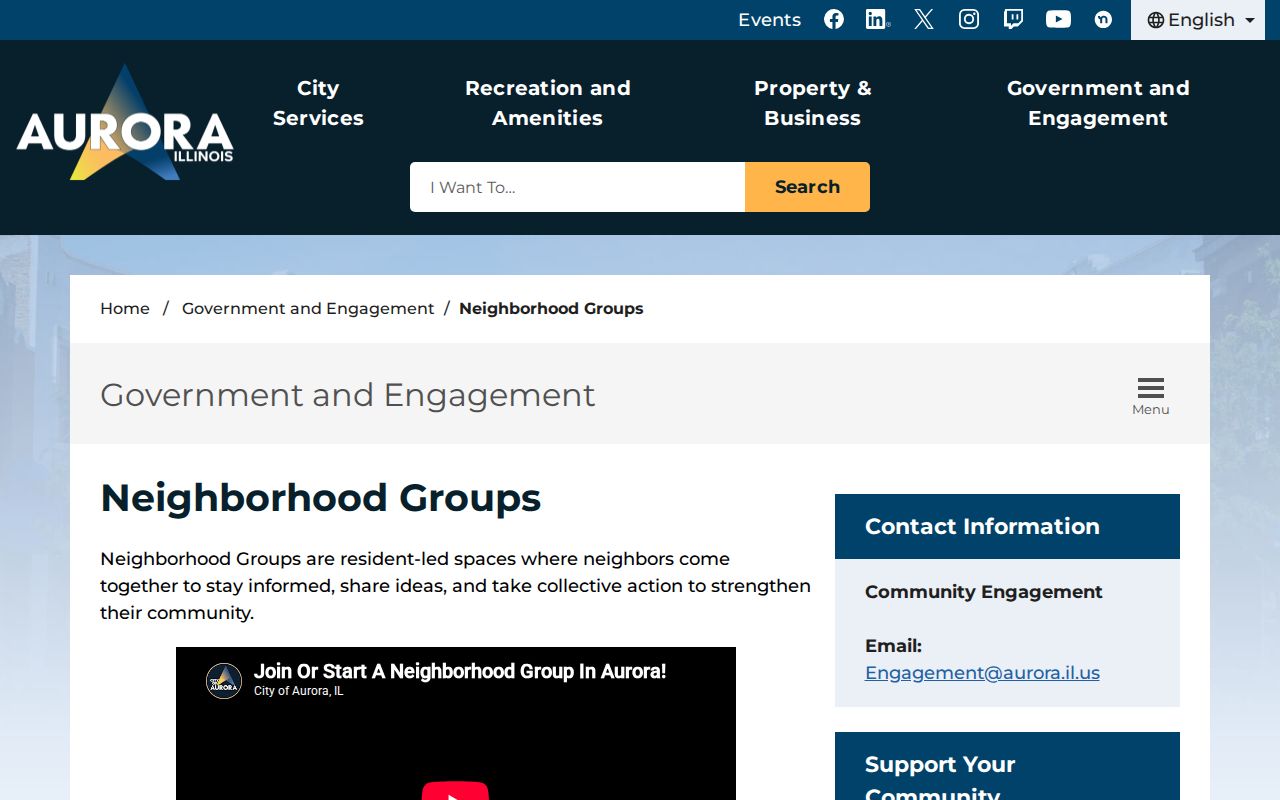
The city list is the right place to find a public meeting or group contact without compiling a private household roster.
Aurora Neighborhood Groups
Ward-based group list, meetings, and city contact routes.
Aurora MyPlace
County, ward, ZIP, district, and service layers for one address.
Official Rolls Beat Neighbor Lists
Official parcel and tax systems identify their custodian, field meaning, and update context. Commercial neighbor tools often blend old addresses, household associations, and unclear sources. They may be quick, but they cannot turn a mailing address into proof of occupancy.
| Source Type | Useful For | Main Limit |
|---|---|---|
| Official GIS and assessor | Parcel, owner, situs, tax context | Does not list every occupant |
| City civic map | Ward and neighborhood geography | Not a member list |
| Commercial compilation | Possible leads | Age, source, and links may be unclear |
Map an Aurora Block in Four Steps
A careful block search keeps geography separate from identity. Start with the exact situs address in Aurora MyPlace and save the county, ward, and PIN. Open that county's parcel viewer, select the target lot, and identify only parcels that share a boundary or fall inside a documented buffer. Then open each parcel in the assessor system and record the tax year, owner or taxpayer label, mailing address, and situs address exactly as shown.
- Standardize the address and confirm that it lies inside Aurora city limits.
- Record the county and PIN before leaving the city map.
- Select adjacent parcels with a county geometry or distance tool.
- Verify each selected PIN in the current assessor record and preserve the update date.
This process identifies recorded parcel relationships around one point. It does not reveal every occupant, guest, family member, or person receiving mail. If the research expands to an entire named road, move to the Aurora street directory rather than stretching a block buffer beyond its purpose.
Aurora County Lines Change the Neighbor Search
Two nearby Aurora addresses may require different county portals. Kane uses KaneGIS, DevNet, and the Buffer tool. DuPage combines its Parcel Viewer with property lookup and export controls. Kendall offers its public property inquiry and map guidance. Will supplies an assessor search and a GIS viewer with parcel, district, aerial, land-use, hydrology, and public-safety layers.
Do not copy a search result from one county into another county's field model. PIN formats, owner labels, update dates, map controls, and document coverage differ. A county line can also change the recorder, circuit clerk, county clerk, election authority, and courthouse. Save county as a field for every parcel in the block research log.
Aurora Voter Data Is Not a Block Roster
The Illinois registration-status form confirms one voter's status through name, birth date, ZIP, street number, and street name. Kane's voter search uses a last name with a house number or street name. These are identity-matching tools, not a way to download everyone on an Aurora block. Returned precinct, polling, district, and sample-ballot details describe election administration.
Illinois law redacts sensitive voter fields and limits dissemination and use. Birth dates entered for matching should not be retained or published. Address Confidentiality Program participants and household members can be excluded or redacted. A missing result may reflect protection, spelling, a move, registration timing, or the wrong election jurisdiction.
Read Aurora Mailing and Situs Fields Apart
A parcel result may show the property's situs, the taxpayer name, and a tax-bill mailing address. Those fields can point to different places and people. An owner may receive mail elsewhere, a trust or estate may hold title, and an assessment can lag a newly recorded deed. The recorder's instrument is the source for a recorded property interest, while neither the deed nor the parcel card identifies all neighbors who live there.
Use source-specific language in notes: “listed taxpayer,” “recorded grantee,” “parcel situs,” or “mailing address.” Add the tax year, instrument date, map date, and retrieval date. That small discipline prevents an official parcel search from becoming an unsupported household claim.
Neighborhood groups add a different type of evidence. Aurora lists resident-led groups by ward with meeting cadence and an Engagement office contact, but it does not publish a membership roster. Northeast Community Group, Pigeon Hill, Lights of Sacred Heart, West Park, Boulevard District Neighbors, Northwest Territory, and Georgetown Neighbors are public civic names tied to areas or meetings. Check the live city page because schedules change. Use the group map to understand a newspaper, meeting packet, or preservation issue, not to assign a household to an organization.
Historical block work also needs dates. Aurora Public Library District recommends combining deeds, former owners, neighbors, churches, newspapers, and physical evidence. Its city directories, address conversion, yearbooks, cemetery indexes, and obituary citations can show who appeared near an address in an earlier era. The Aurora Historical Society adds Sanborn maps, photographs, probate material, and people files by its research route. These collections can explain how a block changed without turning an old entry into a claim about current Aurora neighbors. Cite the volume, page, map year, and retrieval route for each historical clue before comparing households.
Aurora Neighbor Privacy Limits
Utility and delivery records are not a public block directory. Illinois voter access is limited, sensitive fields are redacted, and the law restricts commercial or private misuse. The Address Confidentiality Program can provide a substitute address for qualifying survivors, though it cannot guarantee an old property record disappears.
Wards, ZIPs, precincts, neighborhood boundaries, and parcels are different overlays. None identifies everyone who lives within it. Respect “no result” as a possible privacy protection, access limit, stale field, or county mismatch.
Lawful use. Research Aurora neighbors for civic awareness, family history, or a polite introduction. Never use these records to watch, harass, threaten, or repeatedly contact anyone.